Beyond the Skies: Mapping Drones and the Aerial Revolution
6-7 minutes approx

8 Reasons where we can use mapping drones
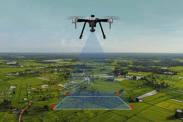
In the ever-evolving landscape of technological advancements,mapping droneshave emerged as a ground-breaking innovation, transforming multiple industries with their unrivalled capabilities. These versatile unmanned aerial vehicles (UAVs), also known as unmanned aircraft systems (UAS), have revolutionized data collection, analysis, and mapping, presenting cost-effective and efficient solutions to a diverse range of sectors. Equipped with advanced sensors and cameras, these small yet agile flying machines have the remarkable ability to capture high-resolution imagery, create 3D models, and gather precise topographic data.
In this blog, we embark on an exciting journey through the world of mapping drones, exploring eight compelling reasons why they have become indispensable tools across various industries. From transforming land surveying into a breeze to fostering eco-conservation efforts from above, these flying wonders have become the wings of innovation, propelling humanity forward.
1. Land Surveying and Mapping: Pioneering Precision from Above
Gone are the days of laborious land surveying. Mapping drones swoop in with their aerial prowess, capturing high-resolution imagery and collecting geospatial data in a fraction of the time. Powered by precise GPS and LiDAR technology, they churn out detailed topographic maps, contour lines, and elevation models - guiding construction, urban planning, and civil engineering projects to soaring success.
2. Environmental Monitoring: Safeguarding Nature with High-Flying Vigilance
In the pursuit of protecting our planet, mapping drones have become invaluable allies. Armed with powerful sensors, they track deforestation, monitor wildlife populations, and detect pollution sources with eagle-eyed precision. Not stopping there, their thermal cameras unveil temperature anomalies in bodies of water, aiding marine research and conservation - ensuring the harmony of nature's symphony.
3. Agriculture and Precision Farming: Nurturing the Future Skyward
Welcome to the agricultural revolution, where mapping drones take the helm. Aerial surveys of farmland provide farmers with a bird's-eye view of crop health, pest infestations, and irrigation needs. Armed with this knowledge, farmers optimize resources, trim costs, and reap bumper harvests, promising a feast for generations to come.
4. Disaster Assessment and Management: Aerial Heroes in Crisis
When calamity strikes, mapping drones soar to the rescue! As nature unleashes its fury, these agile aviators rapidly assess damage, providing critical real-time information to emergency responders. With their reach extending to hard-to-access areas, they empower swift decision-making and resource allocation - lending a helping wing in times of distress.
5. Infrastructure Inspection: Safeguarding Safety from Above
Bridges, power lines, and pipelines stand tall under the watchful gaze of mapping drones. Armed with high-resolution cameras and thermal imaging, these vigilant sentinels inspect infrastructure with hawk-eyed precision - spotting defects and anomalies without risking human lives. Their proactive approach to maintenance ensures the safety of communities below.
6. Archaeological Site Documentation: Unearthing History with Aerial Precision
Unearthing the past takes flight with mapping drones! Archaeologists and researchers wield the power of aerial imaging to document historical landmarks and excavation sites. From ruins to relics, these flying scribes create 3D models and preserve our cultural heritage, unveiling tales etched in the sands of time.
7. Real Estate and Property Management: Elevating Showcases to New Heights
The real estate market soars to new heights with mapping drones in the spotlight. Aerial footage and images give prospective buyers a mesmerizing glimpse of properties from unique angles. Meanwhile, property managers efficiently monitor sprawling estates, luxurious resorts, and bustling complexes - unlocking the potential for unprecedented growth.
8. Filmography and Advertising: Captivating Aerial Cinematics
In the world of storytelling, mapping drones pen awe-inspiring narratives. Aerial shots in movies, commercials, and documentaries add a cinematic touch, bewitching audiences with breath-taking visuals. Advertisers leverage this high-flying technology to capture attention-grabbing footage of products and events, crafting tales that leave lasting impressions.
In this thrilling conclusion, mapping drones have become the true pioneers of innovation, reshaping industries and propelling us towards a limitless future. From revolutionizing land surveying to safeguarding the environment and elevating agriculture, their impact is nothing short of extraordinary. So, let's take flight with these daring aviators, embracing the exhilarating aerial revolution that lies ahead. The horizon beckons with endless possibilities, and together, we soar into a world where the sky is no longer the limit; it's the breath-taking beginning of an extraordinary journey!
Back to all Blog